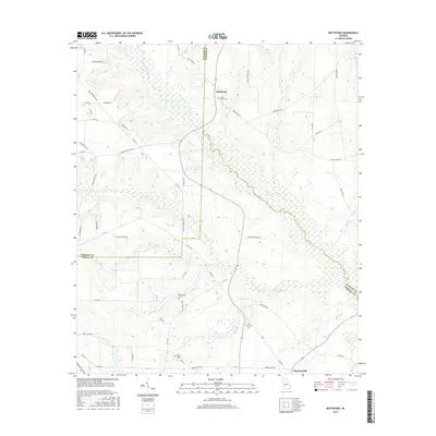
2017 Map of Bottsford
USGS Topo · Published 2017About this map
Kinchafonee Creek and its broad, marshy basin dominate this Southwest Georgia landscape at the intersection of Sumter, Webster, and Terrell counties. The 2017 terrain is characterized by a dense network of country roads and small family-named landmarks that reflect generations of rural settlement. In the northern reaches, the community of Bottsford sits near Saint Marks Cem, while the southern portion of the map identifies the settlement of Pleasant Hill.
Find a feature on this map
65 named features on this map. Tap any name to fly to it.
Don’t see what you’re looking for? This feature index may not catch every label — zoom into the map to look around manually.
Map Details
Editions of this 2017 Bottsford Map
This is the sole edition of this map. No revisions or reprints were ever made.
Other maps of this area

1953 · Dothan
USGS Topo · 1:250,000

1954 · Dothan
USGS Topo · 1:250,000

1955 · Dothan
USGS Topo · 1:250,000

1955 · Phenix City
USGS Topo · 1:250,000

1957 · Phenix City
USGS Topo · 1:250,000

1958 · Phenix City
USGS Topo · 1:250,000
1972 · Preston
USGS Topo · 1:24,000

1972 · Parrott
USGS Topo · 1:24,000

1972 · Shellman
USGS Topo · 1:24,000

1973 · Dawson
USGS Topo · 1:24,000