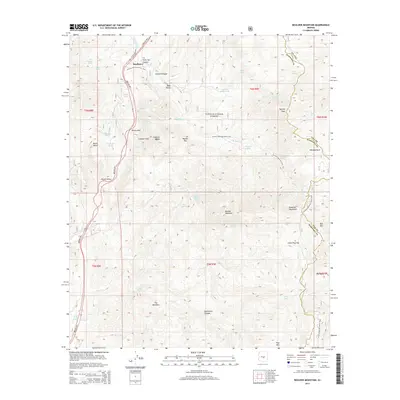
2014 Map of Boulder Mountain
USGS Topo · Published 2014About this map
The settlement of Sunflower and the small pocket of Round Valley sit along the corridor of the Beeline Hwy, serving as key transit points through the high desert. This area of the Tonto National Forest is defined by sharp topographic shifts where the Mazatzal Mountains rise over the surrounding canyons. A complex network of springs and tanks, such as Bushnell Sheep Tank, O'Neil Tank, and Circle M Spring, reflects the vital water management required for ranching and wildlife in this arid environment.
Find a feature on this map
53 named features on this map. Tap any name to fly to it.
Don’t see what you’re looking for? This feature index may not catch every label — zoom into the map to look around manually.
Map Details
Editions of this 2014 Boulder Mountain Map
This is the sole edition of this map. No revisions or reprints were ever made.
Other maps of this area

1904 · Ft. McDowell
USGS Topo · 1:62,500

1906 · Ft. McDowell
USGS Topo · 1:62,500

1907 · Roosevelt
USGS Topo · 1:125,000

1909 · Four Peaks
USGS Topo · 1:125,000

1912 · Roosevelt
USGS Topo · 1:125,000

1930 · Cave Creek
USGS Topo · 1:125,000

1939 · Cave Creek
USGS Topo · 1:125,000

1954 · Mesa
USGS Topo · 1:250,000

1957 · Mesa
USGS Topo · 1:250,000

1958 · Mesa
USGS Topo · 1:250,000