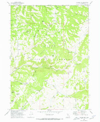
1969 Map of Boulder Mtn
USGS Topo · Published 1973About this map
Cache National Forest encompasses this high-altitude landscape in northern Utah, where the topography is defined by the massive Boulder Mtn and a network of deep drainages. The Lucky Star Mine is a notable point of human activity within these peaks, reachable via a network of Pack Trails and Jeep Trails that crisscross the terrain. Water sources are abundant and specifically named throughout the quadrangle, ranging from Sow Hole Spring and Mosslander Spring in the south to Humming Bird Spring further north.
Find a feature on this map
57 named features on this map. Tap any name to fly to it.
Don’t see what you’re looking for? This feature index may not catch every label — zoom into the map to look around manually.
Map Details
Editions of this 1969 Boulder Mtn Map
3 editions found
Other maps of this area

1912 · Randolph
USGS Topo · 1:125,000

1914 · Logan
USGS Topo · 1:125,000

1916 · Logan
USGS Topo · 1:125,000

1949 · Boulter Mts
USGS Topo · 1:24,000

1954 · Ogden
USGS Topo · 1:250,000

1958 · Ogden
USGS Topo · 1:250,000

1960 · Ogden
USGS Topo · 1:250,000

1969 · Boulder Mtn
USGS Topo · 1:24,000
1969 · Porcupine Reservoir
USGS Topo · 1:24,000
1969 · Hardware Ranch
USGS Topo · 1:24,000