
1952 Map of Bountiful Peak
USGS Topo · Published 1954About this map
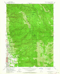
Centerville and Bountiful City sit at the base of the massive Wasatch Range, where the canyon-carved landscape of the Wasatch National Forest meets the valley floor. In the early 1950s, the urban grid of these Utah communities was already well-defined, featuring landmarks like Bountiful High School and a local Cemetery. Beyond the residential streets, the terrain rises sharply toward Bountiful Peak, accessed by the winding Skyline Drive. The map reveals a high-altitude network of research and management sites, including the Farmington Creek Research Center, Parrish Creek Research Center, and the Farmington Guard Station. These stations, along with Farmington Lake and the Bountiful Peak Campground, illustrate the dual role of the mountains as both a critical watershed for the towns below and a managed recreational and scientific resource during this era.
Find a feature on this map
55 named features on this map. Tap any name to fly to it.
Don’t see what you’re looking for? This feature index may not catch every label — zoom into the map to look around manually.
Map Details
Editions of this 1952 Bountiful Peak Map
5 editions found
Other maps of this area

1885 · Salt Lake
USGS Topo · 1:250,000

1925 · Ft. Douglas
USGS Topo · 1:125,000

1928 · Ft. Douglas
USGS Topo · 1:125,000

1950 · Fort Douglas
USGS Topo · 1:24,000

1951 · Fort Douglas
USGS Topo · 1:24,000

1951 · Salt Lake City North
USGS Topo · 1:24,000

1952 · Farmington
USGS Topo · 1:24,000

1954 · Salt Lake City
USGS Topo · 1:250,000

1954 · Ogden
USGS Topo · 1:250,000

1955 · Peterson
USGS Topo · 1:24,000