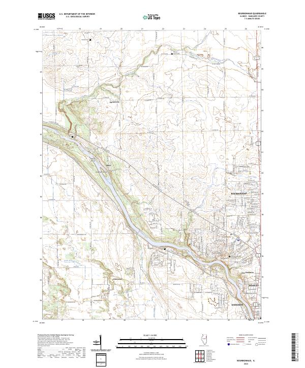
2024 Map of Bourbonnais
USGS Topo · Published 2024About this map
The Kankakee River dominates the center of this landscape, carving a path through Kankakee County and sheltering Willow Island and Langham Island within its current. Along its banks, the settlements of Bourbonnais and Bradley show significant urban density, contrasting with the agrarian layout of the surrounding townships. Smaller named localities like Flickerville, Altorf, and First Pommier punctuate the grid of rural roads, while the presence of DeSelm Cem, Smith Cem, and the Maternity Blessed Virgin Mary Cem provide vital touchpoints for genealogical research.
Find a feature on this map
83 named features on this map. Tap any name to fly to it.
Don’t see what you’re looking for? This feature index may not catch every label — zoom into the map to look around manually.
Map Details
Editions of this 2024 Bourbonnais Map
This is the sole edition of this map. No revisions or reprints were ever made.
Other maps of this area

1892 · Wilmington
USGS Topo · 1:62,500

1918 · Wilmington
USGS Topo · 1:62,500

1922 · Kankakee
USGS Topo · 1:62,500

1923 · Herscher
USGS Topo · 1:62,500

1924 · Kankakee
USGS Topo · 1:62,500

1925 · Herscher
USGS Topo · 1:62,500

1949 · Peotone
USGS Topo · 1:62,500

1953 · Peotone
USGS Topo · 1:24,000

1953 · Wilton Center
USGS Topo · 1:24,000

1953 · Symerton
USGS Topo · 1:24,000