
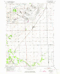
1953 Map of Symerton
USGS Topo · Published 1955About this map
The sprawling industrial footprint of the Joliet Arsenal dominates the northern portion of this Illinois landscape during the early 1950s. This massive federal installation, served by the Government Railroad, stands in sharp contrast to the surrounding agricultural townships of Florence, Wilton, and Wesley. The terrain is marked by the diagonal path of the Old Indian Boundary, which slices through the section lines and underscores the region's early colonial surveying history.
Find a feature on this map
23 named features on this map. Tap any name to fly to it.
Don’t see what you’re looking for? This feature index may not catch every label — zoom into the map to look around manually.
Map Details
Editions of this 1953 Symerton Map
2 editions found
Other maps of this area

1892 · Wilmington
USGS Topo · 1:62,500

1918 · Wilmington
USGS Topo · 1:62,500

1922 · Kankakee
USGS Topo · 1:62,500

1923 · Herscher
USGS Topo · 1:62,500

1924 · Kankakee
USGS Topo · 1:62,500

1925 · Herscher
USGS Topo · 1:62,500

1929 · Brisbane
USGS Topo · 1:24,000

1949 · Peotone
USGS Topo · 1:62,500
1953 · Manhattan
USGS Topo · 1:24,000

1953 · Wilton Center
USGS Topo · 1:24,000