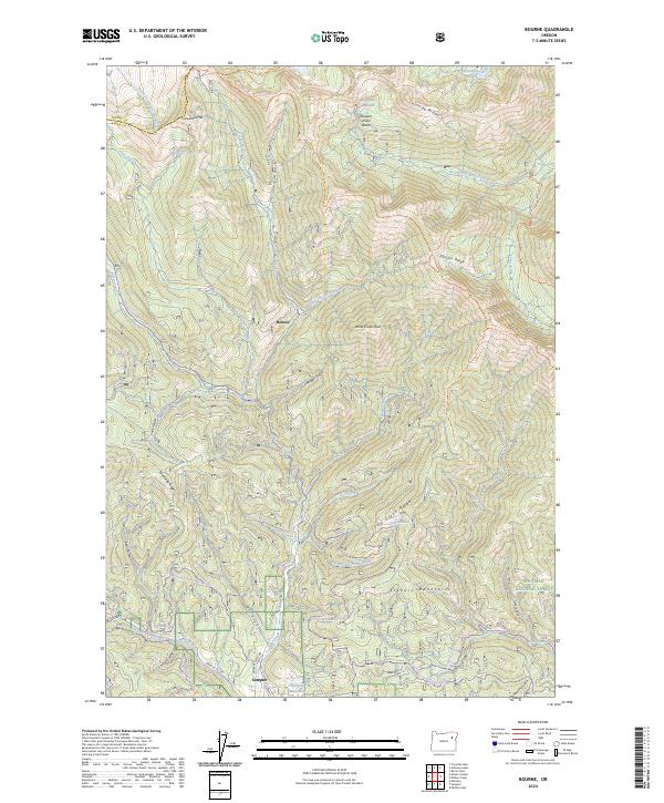
2024 Map of Bourne
USGS Topo · Published 2024About this map
Sumpter and the smaller settlement of Bourne occupy a high-elevation landscape defined by the drainages of Cracker Creek and the McCully Fork. This modern survey reveals a complex network of recreational paths, including the Sumpter Loop Snowmobile Trail and the high-elevation Elkhorn Crest Trail that traverses Elkhorn Ridge. The area is characterized by steep glacial topography and resource management within the Whitman National Forest, with significant water features like the Sumpter Reservoir and alpine bodies such as Killamacue Lake. The map details the transition between the mining-era settlements in the valley floors and the protected heights of the North Fork John Day Wilderness. Prominent landmarks like Wind Creek Peak and the rugged Chloride Ridge dominate the northern skyline, while the historic boundary between Grant and Baker counties cuts through the northwest corner near the North Fork John Day River.
Find a feature on this map
70 named features on this map. Tap any name to fly to it.
Don’t see what you’re looking for? This feature index may not catch every label — zoom into the map to look around manually.
Map Details
Editions of this 2024 Bourne Map
This is the sole edition of this map. No revisions or reprints were ever made.
Other maps of this area

1901 · Sumpter
USGS Topo · 1:125,000

1955 · Canyon City
USGS Topo · 1:250,000

1959 · Canyon City
USGS Topo · 1:250,000

1961 · Whitney
USGS Topo · 1:24,000
1972 · Elkhorn Peak
USGS Topo · 1:24,000

1972 · Mt. Ireland
USGS Topo · 1:24,000
1972 · Bourne
USGS Topo · 1:24,000
1972 · Phillips Lake
USGS Topo · 1:24,000
1972 · Rock Creek
USGS Topo · 1:24,000
1972 · Sumpter
USGS Topo · 1:24,000