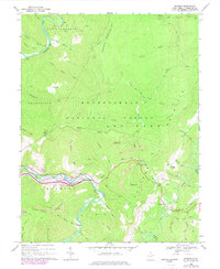
1968 Map of Bowden
USGS Topo · Published 1977About this map
Shavers Fork and Glady Fork define the riverine character of this West Virginia mountain landscape, where the Western Maryland railroad follows the winding banks through the heart of the Monongahela National Forest. The settlement of Bowden serves as a central point for the local community, featuring a Fish Hatchery and proximity to multiple recreation areas like Bickle Knob, which is marked by the prominent Bickle Knob Lookout Tower. Resource extraction and land management are visible through numerous labels for Strip Mines, a Tipple, and several gas wells scattered across the terrain.
Find a feature on this map
69 named features on this map. Tap any name to fly to it.
Don’t see what you’re looking for? This feature index may not catch every label — zoom into the map to look around manually.
Map Details
Editions of this 1968 Bowden Map
4 editions found
Other maps of this area

1886 · St. George
USGS Topo · 1:125,000

1889 · Beverly
USGS Topo · 1:125,000

1891 · St. George
USGS Topo · 1:125,000

1892 · Beverly
USGS Topo · 1:125,000

1907 · Belington
USGS Topo · 1:62,500

1908 · Parsons
USGS Topo · 1:62,500

1909 · Elkins
USGS Topo · 1:62,500

1922 · Horton
USGS Topo · 1:48,000

1924 · Horton
USGS Topo · 1:62,500

1926 · Parsons
USGS Topo · 1:62,500