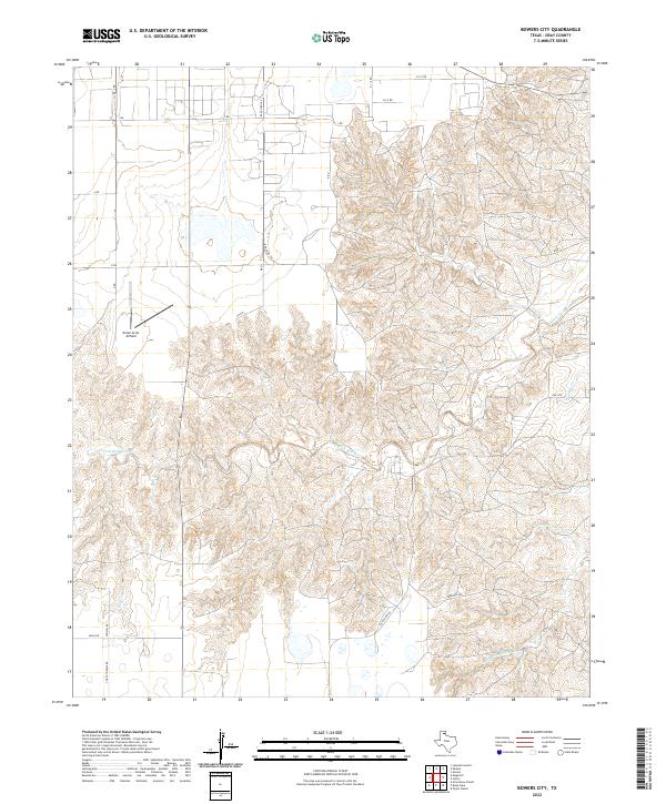
2022 Map of Bowers City
USGS Topo · Published 2022About this map
The North Fork Red River carves a complex drainage system through this portion of Gray County, defining the local topography with its deeply etched tributaries. In the western section, the landscape transitions from these breaks into flatter plains marked by a grid of rural routes such as J Rd and K Rd. This area is home to the Green Acres Airfield, a private aviation landmark situated amidst the agricultural and ranching lands of the Texas Panhandle.
Find a feature on this map
20 named features on this map. Tap any name to fly to it.
Don’t see what you’re looking for? This feature index may not catch every label — zoom into the map to look around manually.
Map Details
Editions of this 2022 Bowers City Map
This is the sole edition of this map. No revisions or reprints were ever made.
Other maps of this area

1954 · Amarillo
USGS Topo · 1:250,000

1958 · Amarillo
USGS Topo · 1:250,000

1963 · Pampa
USGS Topo · 1:24,000

1965 · Lake Mc Connell
USGS Topo · 1:24,000

1966 · Grandview School
USGS Topo · 1:24,000

1966 · Kingsmill
USGS Topo · 1:24,000

1966 · Bowers City
USGS Topo · 1:24,000

1967 · Lefors
USGS Topo · 1:24,000

1967 · Hoover
USGS Topo · 1:24,000

1968 · Taylor Ranch
USGS Topo · 1:24,000