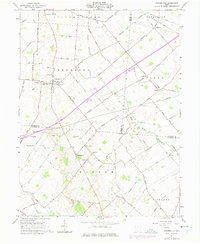
1961 Map of Bowersville
USGS Topo · Published 1975About this map
The village of Bowersville anchors this mid-century survey of the rural landscape where Greene, Clinton, and Fayette counties meet. A prominent stretch of the Baltimore and Ohio railroad cuts through the northern townships of Silver Creek and Jefferson, serving the small community of Edgefield. The map reveals a densely settled agricultural region defined by numerous family-named landmarks and local institutions, including Greeneview South Sch and several pioneer-era burial grounds such as Hussey Cem and Stewart Cem.
Find a feature on this map
90 named features on this map. Tap any name to fly to it.
Don’t see what you’re looking for? This feature index may not catch every label — zoom into the map to look around manually.
Map Details
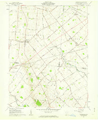
Editions of this 1961 Bowersville Map
2 editions found
Other maps of this area

1907 · Blanchester
USGS Topo · 1:62,500

1916 · Octa
USGS Topo · 1:62,500

1917 · Xenia
USGS Topo · 1:62,500

1917 · Sabina
USGS Topo · 1:62,500

1943 · Sabina
USGS Topo · 1:62,500

1944 · Octa
USGS Topo · 1:62,500

1947 · Columbus
USGS Topo · 1:250,000

1955 · Cedarville
USGS Topo · 1:24,000

1955 · Port William
USGS Topo · 1:24,000

1961 · Columbus
USGS Topo · 1:250,000