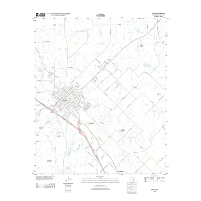
2013 Map of Bowie
USGS Topo · Published 2013About this map
Bowie serves as a significant rail and highway crossroads in Montague County, defined by the Burlington Northern Santa Fe railroad corridor. The settlement pattern radiates from the city center toward outlying areas like McDonald and Fruitland, reflecting the region's steady development. Notable for genealogists, the map identifies several burial grounds including Elmwood Cem, Saint Peters Cem, and Brushy Cem. The landscape transitions from the urban grid of Bowie to the more varied terrain of Cougar Mountain and Grindstone Mountain to the west. Industrial activity is evident through the presence of the Mueller Oil Field and Osage Oil Field, while the local hydrology is shaped by Denton Cr, Brushy Cr, and the Soil Conservation Service Site 18 Reservoir. Public infrastructure like the Bowie Municipal Airport highlights the city's role as a regional hub.
Find a feature on this map
135 named features on this map. Tap any name to fly to it.
Don’t see what you’re looking for? This feature index may not catch every label — zoom into the map to look around manually.
Map Details
Editions of this 2013 Bowie Map
This is the sole edition of this map. No revisions or reprints were ever made.
Other maps of this area

1905 · Montague
USGS Topo · 1:125,000

1954 · Sherman
USGS Topo · 1:250,000

1958 · Sherman
USGS Topo · 1:250,000

1960 · Buzzard Roost Knob
USGS Topo · 1:24,000

1961 · Stoneburg
USGS Topo · 1:24,000

1961 · Salona
USGS Topo · 1:24,000

1961 · Brushy Mound
USGS Topo · 1:24,000

1961 · Selma
USGS Topo · 1:24,000

1961 · Montague
USGS Topo · 1:24,000

1961 · Sunset
USGS Topo · 1:24,000