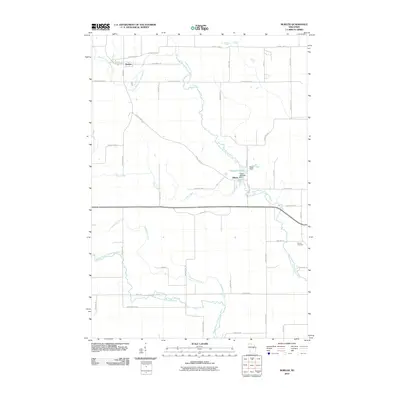
2010 Map of Bowler
USGS Topo · Published 2010About this map
The North Branch Embarrass River and its various tributaries, including Pony Creek and Logemanns Creek, anchor the landscape of this Shawano County region. In the northern reaches, the village of Bowler sits near the riverbanks, while the smaller settlement of Tilleda is situated further south, defined by the Tilleda Pond and the Tilleda Dam. This area exhibits a typical Wisconsin township grid, where local life revolves around agricultural roads and family-named landmarks like Maas Field. For those researching local lineages, the Seneca Cemetery provides a focal point on the eastern edge of the survey. The river system, including the Middle Branch Embarrass River, remains the primary geographic feature, dictating the placement of early crossings and the growth of these rural communities.
Find a feature on this map
45 named features on this map. Tap any name to fly to it.
Don’t see what you’re looking for? This feature index may not catch every label — zoom into the map to look around manually.
Map Details
Editions of this 2010 Bowler Map
This is the sole edition of this map. No revisions or reprints were ever made.
Other maps of this area

1954 · Wittenberg
USGS Topo · 1:48,000

1954 · Gresham
USGS Topo · 1:48,000

1955 · Clintonville
USGS Topo · 1:48,000

1955 · Tigerton
USGS Topo · 1:48,000

1955 · Green Bay
USGS Topo · 1:250,000

1964 · Wittenberg
USGS Topo · 1:62,500

1964 · Gresham
USGS Topo · 1:62,500

1970 · Clintonville North
USGS Topo · 1:24,000
1970 · Marion
USGS Topo · 1:24,000
1970 · Tigerton
USGS Topo · 1:24,000