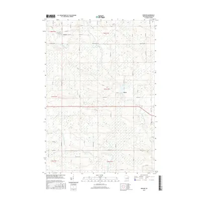
2016 Map of Bowler
USGS Topo · Published 2016About this map
Bowler serves as a primary hub in this Shawano County landscape, where the local road network converges near the N Br Embarrass River. The terrain is defined by the winding paths of the North Branch Embarrass River and the Middle Branch Embarrass River, illustrating a region shaped by its waterways. To the southeast, the village of Tilleda is situated near the Tilleda Pond, while the Seneca Cem provides a point of interest for genealogists tracing local families in the township. Smaller tributaries like Pony Cr and Logemanns Cr weave between section lines, alongside rural routes such as Wittbirn Townline Rd and School House Rd, which hint at the historic placement of early civic structures.
Find a feature on this map
64 named features on this map. Tap any name to fly to it.
Don’t see what you’re looking for? This feature index may not catch every label — zoom into the map to look around manually.
Map Details
Editions of this 2016 Bowler Map
This is the sole edition of this map. No revisions or reprints were ever made.
Other maps of this area

1954 · Wittenberg
USGS Topo · 1:48,000

1954 · Gresham
USGS Topo · 1:48,000

1955 · Clintonville
USGS Topo · 1:48,000

1955 · Tigerton
USGS Topo · 1:48,000

1955 · Green Bay
USGS Topo · 1:250,000

1964 · Wittenberg
USGS Topo · 1:62,500

1964 · Gresham
USGS Topo · 1:62,500

1970 · Clintonville North
USGS Topo · 1:24,000
1970 · Marion
USGS Topo · 1:24,000
1970 · Tigerton
USGS Topo · 1:24,000