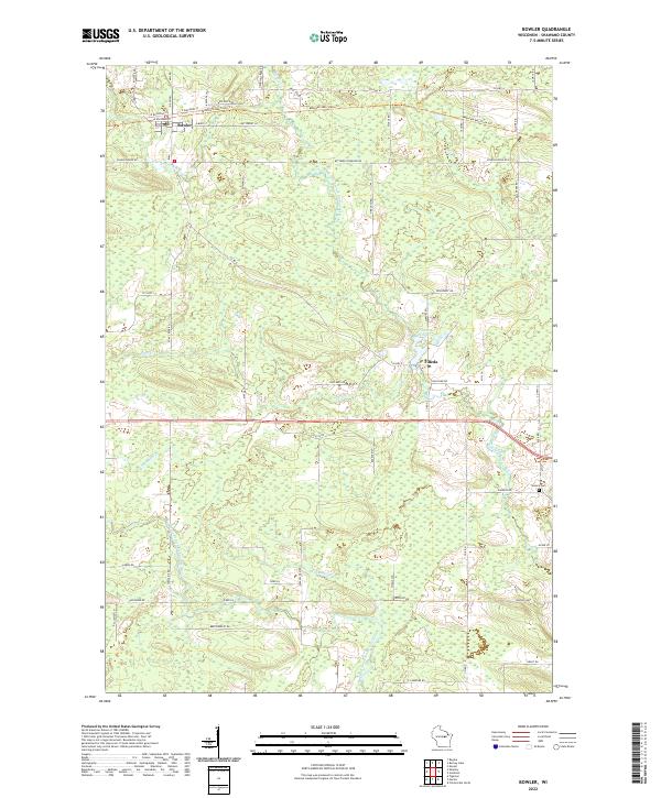
2022 Map of Bowler
USGS Topo · Published 2022About this map
Bowler and Tilleda serve as the primary hubs of activity in this section of Shawano County, defined by a landscape intricately carved by the waterways of the Embarrass River system. The North Branch Embarrass River and its various tributaries, including Pony Cr and Henning Cr, create a network of drainage that historically influenced local agriculture and settlement patterns. The presence of the Mountain-Bay State Trl, which follows an east-west path through Bowler, reflects the transition of former rail corridors into modern recreational use. Near the village of Tilleda, the Tilleda Pond provides a significant localized water feature, while the Seneca Cem located to the southeast offers a point of interest for those researching local family histories and early community footprints in the region.
Find a feature on this map
62 named features on this map. Tap any name to fly to it.
Don’t see what you’re looking for? This feature index may not catch every label — zoom into the map to look around manually.
Map Details
Editions of this 2022 Bowler Map
This is the sole edition of this map. No revisions or reprints were ever made.
Other maps of this area

1954 · Wittenberg
USGS Topo · 1:48,000

1954 · Gresham
USGS Topo · 1:48,000

1955 · Clintonville
USGS Topo · 1:48,000

1955 · Tigerton
USGS Topo · 1:48,000

1955 · Green Bay
USGS Topo · 1:250,000

1964 · Wittenberg
USGS Topo · 1:62,500

1964 · Gresham
USGS Topo · 1:62,500

1970 · Clintonville North
USGS Topo · 1:24,000
1970 · Marion
USGS Topo · 1:24,000
1970 · Tigerton
USGS Topo · 1:24,000