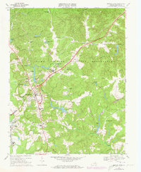
1969 Map of Bowling Green
USGS Topo · Published 1973About this map
Camp A P Hill Military Reservation dominates much of this Caroline County landscape, characterized by numerous observation towers, range corners, and established posts like Raymonds Fork and Baylortown. The town of Bowling Green serves as a central hub, where the intersection of local routes meets the extensive rail corridor of the Richmond Fredericksburg and Potomac. This 1969 survey, with purple-shaded 1972 revisions, illustrates the expansion of infrastructure near the military installation, including Airstrip No 1 and various sewage disposal sites.
Find a feature on this map
49 named features on this map. Tap any name to fly to it.
Don’t see what you’re looking for? This feature index may not catch every label — zoom into the map to look around manually.
Map Details
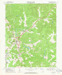
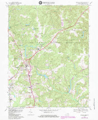
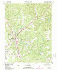
Editions of this 1969 Bowling Green Map
4 editions found
Other maps of this area

1889 · Fredericksburg
USGS Topo · 1:125,000

1892 · Fredericksburg
USGS Topo · 1:125,000

1894 · Fredericksburg
USGS Topo · 1:125,000

1918 · Doswell
USGS Topo · 1:62,500

1918 · Aylett
USGS Topo · 1:62,500

1933 · Aylett
USGS Topo · 1:62,500

1942 · Bowling Green
USGS Topo · 1:31,680

1942 · Upper Zion
USGS Topo · 1:31,680

1942 · Woodford
USGS Topo · 1:31,680

1942 · Guinea
USGS Topo · 1:31,680