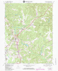
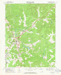
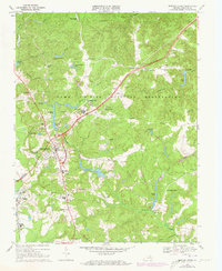
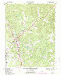
1969 Map of Bowling Green
USGS Topo · Published 1984About this map
Bowling Green serves as the central hub of this Caroline County landscape, situated just west of the sprawling Fort A P Hill Military Reservation. The map reveals a transition from the structured street grid of the county seat to the expansive tactical training grounds of the military post, which is dotted with numerous Observation Towers and specialized routes like Firebreak and Blue Gill Rd. The surrounding countryside is defined by several crossroads and corners, including Acors Corner and Carters Corner, which anchor the local community fabric.
Find a feature on this map
52 named features on this map. Tap any name to fly to it.
Don’t see what you’re looking for? This feature index may not catch every label — zoom into the map to look around manually.
Map Details
Editions of this 1969 Bowling Green Map
4 editions found
Other maps of this area

1889 · Fredericksburg
USGS Topo · 1:125,000

1892 · Fredericksburg
USGS Topo · 1:125,000

1894 · Fredericksburg
USGS Topo · 1:125,000

1918 · Doswell
USGS Topo · 1:62,500

1918 · Aylett
USGS Topo · 1:62,500

1933 · Aylett
USGS Topo · 1:62,500

1942 · Bowling Green
USGS Topo · 1:31,680

1942 · Upper Zion
USGS Topo · 1:31,680

1942 · Woodford
USGS Topo · 1:31,680

1942 · Guinea
USGS Topo · 1:31,680