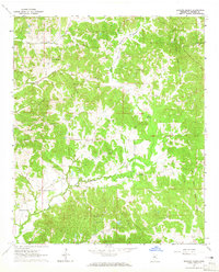
1964 Map of Bowling Green
USGS Topo · Published 1965About this map
Bowling Green and the surrounding Holmes County countryside are defined by a complex network of small watercourses and family-named sites in the mid-1960s. The landscape is bisected by the Old Indian Treaty Boundary, which zigzags across the terrain, following the winding path of Black Creek and other local drainage. This survey reflects a deeply rooted rural community, marked by a high density of small churches and family burial grounds that served the dispersed population.
Find a feature on this map
27 named features on this map. Tap any name to fly to it.
Don’t see what you’re looking for? This feature index may not catch every label — zoom into the map to look around manually.
Map Details
Editions of this 1964 Bowling Green Map
2 editions found
Other maps of this area

1940 · Seven Pines
USGS Topo · 1:62,500

1940 · Lexington
USGS Topo · 1:62,500

1953 · Greenwood
USGS Topo · 1:250,000

1953 · West Point
USGS Topo · 1:250,000

1956 · Greenwood
USGS Topo · 1:250,000

1957 · Lexington
USGS Topo · 1:62,500

1957 · Seven Pines
USGS Topo · 1:62,500

1958 · West Point
USGS Topo · 1:250,000

1958 · Seven Pines
USGS Topo · 1:62,500

1958 · Lexington
USGS Topo · 1:62,500