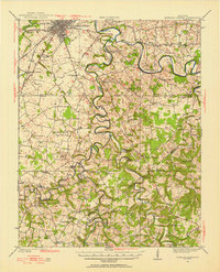
1985 Map of Bowling Green
USGS Topo · Published 1998About this map
Bowling Green serves as the regional anchor for this mid-1980s portrait of the Pennyroyal Plateau, where the central Kentucky landscape transitions across the state line into Tennessee. The region’s connectivity is defined by the Seaboard rail line and a network of secondary roads linking established hubs like Russellville, Franklin, and Springfield. The Barren River and its major tributaries, including Drakes Creek and Trammel Fork, dictate the drainage patterns of this agricultural and transit corridor. To the east, the Barren River Lake State Resort Park marks a significant recreational and conservation area. Researchers will find numerous smaller settlements and landmarks of local importance, such as the Highland Academy near the Tennessee border and religious sites like Chapel Hill, providing a detailed look at the rural social geography of Warren, Logan, and Simpson counties during this era.
Find a feature on this map
163 named features on this map. Tap any name to fly to it.
Don’t see what you’re looking for? This feature index may not catch every label — zoom into the map to look around manually.
Map Details
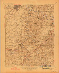
Editions of this 1985 Bowling Green Map
3 editions found

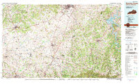
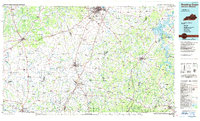
Historical Maps of Bowling Green Through Time
3 maps found