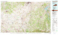
1985 Map of Bowling Green
USGS Topo · Published 1991About this map
Bowling Green and the rolling Pennyroyal Plateau are the focus of this 1985 mid-century survey, which reveals the complex hydrology and transportation networks along the Kentucky and Tennessee border. The Barren River meanders toward the northeast, backed by the significant reservoir at Barren River Lake and its accompanying Barren River Lake State Resort Park. This era shows the continued prominence of the L & N RR, which serves as a backbone for the settlements of Franklin, Russellville, and Springfield.
Find a feature on this map
196 named features on this map. Tap any name to fly to it.
Don’t see what you’re looking for? This feature index may not catch every label — zoom into the map to look around manually.
Map Details
Editions of this 1985 Bowling Green Map
3 editions found
Other maps of this area

1903 · Nashville
USGS Topo · 1:125,000

1911 · Drakesboro
USGS Topo · 1:48,000

1911 · Dunmor
USGS Topo · 1:48,000

1913 · Drakesboro
USGS Topo · 1:62,500

1914 · Little Muddy
USGS Topo · 1:62,500

1914 · Dunmor
USGS Topo · 1:62,500

1921 · Bowling Green
USGS Topo · 1:62,500

1922 · Brownsville
USGS Topo · 1:62,500

1922 · Mammoth Cave
USGS Topo · 1:62,500

1923 · Bowling Green
USGS Topo · 1:62,500