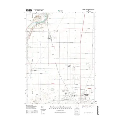
2013 Map of Bowling Green North
USGS Topo · Published 2013About this map
The Maumee River forms the northwestern boundary of this 2013 survey, where landmarks like Roche de Boeuf and Granger Island stand as geological features amidst the water. The landscape is characterized by its agricultural grid, dotted with small settlements like Haskins, Tontogany, and the expansive Bowling Green State University Main Campus. Aviation and transport history are evident through the presence of Nietz Airport, Conklin Airport, and the Wood County Airport.
Find a feature on this map
117 named features on this map. Tap any name to fly to it.
Don’t see what you’re looking for? This feature index may not catch every label — zoom into the map to look around manually.
Map Details
Editions of this 2013 Bowling Green North Map
This is the sole edition of this map. No revisions or reprints were ever made.
Other maps of this area

1900 · Toledo
USGS Topo · 1:62,500

1901 · Bowling Green
USGS Topo · 1:62,500

1903 · Bowling Green
USGS Topo · 1:62,500

1909 · Mc Clure
USGS Topo · 1:62,500

1911 · Swanton
USGS Topo · 1:62,500

1914 · Swanton
USGS Topo · 1:62,500

1934 · Rossford
USGS Topo · 1:24,000

1935 · Grand Rapids
USGS Topo · 1:24,000

1935 · Whitehouse
USGS Topo · 1:24,000

1935 · Maumee
USGS Topo · 1:24,000