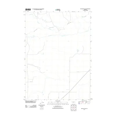
2011 Map of Box Butte NE
USGS Topo · Published 2011About this map
The Niobrara River flows eastward across this high plains landscape, defining the local hydrology alongside its tributary, Pepper Creek. This 2011 survey documents a rural section of Box Butte County where agricultural water management is central to the land use, most notably evidenced by the winding path of the Mirage Flats Canal. The canal system represents a significant engineering footprint in the Nebraska Panhandle, diverted to support the region's farming economy.
Find a feature on this map
11 named features on this map. Tap any name to fly to it.
Don’t see what you’re looking for? This feature index may not catch every label — zoom into the map to look around manually.
Map Details
Editions of this 2011 Box Butte NE Map
This is the sole edition of this map. No revisions or reprints were ever made.
Other maps of this area

1947 · Box Butte NE
USGS Topo · 1:24,000

1947 · Box Butte
USGS Topo · 1:24,000

1947 · Box Butte NW
USGS Topo · 1:24,000

1949 · Box Butte NE
USGS Topo · 1:24,000

1949 · Box Butte SW
USGS Topo · 1:24,000

1949 · Box Butte
USGS Topo · 1:24,000

1949 · Box Butte NW
USGS Topo · 1:24,000

1950 · Skunk Lake
USGS Topo · 1:62,500

1955 · Alliance
USGS Topo · 1:250,000

1957 · Alliance
USGS Topo · 1:250,000