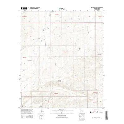
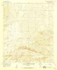
2013 Map of Box Canyon Ranch
USGS Topo · Published 2013About this map
Box Canyon Ranch and Cass Ranch anchor this landscape of the High Plains, where the terrain is defined by an intricate network of ephemeral drainage systems. These features, often labeled as draws, reflect the arid hydrology of Eddy County, with North Prong Long Draw and South Prong Long Draw carving significant paths through the township. The nomenclature of the land suggests a challenging environment for early settlers and ranchers, evidenced by names like Strychnine Draw, Cat Claw Draw, and Buzzard Canyon. Transportation across this rangeland relies on a sparse grid of local routes, including Co Road 23A and Armstrong Rd, which connect isolated ranching outposts. The topographic detail captures the abrupt elevation changes of Little Box Canyon and Box Canyon, illustrating the geological transition between the limestone uplands and the drainage basins below.
Find a feature on this map
27 named features on this map. Tap any name to fly to it.
Don’t see what you’re looking for? This feature index may not catch every label — zoom into the map to look around manually.
Map Details
Editions of this 2013 Box Canyon Ranch Map
This is the sole edition of this map. No revisions or reprints were ever made.
Other maps of this area
1940 · Bandanna Point
USGS Topo · 1:62,500
1943 · Bandanna Point
USGS Topo · 1:62,500
1943 · Texas Hill
USGS Topo · 1:62,500
1945 · Texas Hill
USGS Topo · 1:62,500

1954 · Carlsbad
USGS Topo · 1:250,000
1956 · Parish Ranch
USGS Topo · 1:24,000
1956 · Antelope Sink
USGS Topo · 1:24,000
1957 · Foster Ranch
USGS Topo · 1:24,000
1957 · Box Canyon Ranch
USGS Topo · 1:24,000

1958 · Carlsbad
USGS Topo · 1:250,000