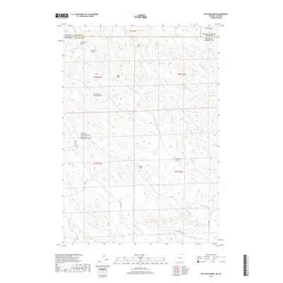
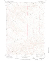
2017 Map of Box Elder Draw
USGS Topo · Published 2017About this map
Coal Mine Draw and King Geyser Draw highlight the geologic and industrial history of this borderland between Sheridan County, Wyoming, and the Montana counties of Big Horn and Powder River. The landscape is defined by an intricate network of drainages and seasonal draws, including the central Box Elder Draw and the various branches of Seventysix Cr. The presence of labels like Schoolhouse Prong suggests the locations of earlier rural infrastructure and community focal points in this ranching country. Transportation through the hills is anchored by Hanging Woman Rd, which follows the contours of Hanging Woman Cr and its tributaries. This map provides a detailed view of the high plains terrain before the headwaters of the S Fork N Buffalo Cr, documenting a sparsely populated region shaped by water access and small-scale resource extraction.
Find a feature on this map
29 named features on this map. Tap any name to fly to it.
Don’t see what you’re looking for? This feature index may not catch every label — zoom into the map to look around manually.
Map Details
Editions of this 2017 Box Elder Draw Map
This is the sole edition of this map. No revisions or reprints were ever made.
Other maps of this area

1954 · Hardin
USGS Topo · 1:250,000

1955 · Sheridan
USGS Topo · 1:250,000

1957 · Hardin
USGS Topo · 1:250,000

1958 · Hardin
USGS Topo · 1:250,000

1958 · Sheridan
USGS Topo · 1:250,000

1962 · Sheridan
USGS Topo · 1:250,000
1971 · Shuler Draw
USGS Topo · 1:24,000
1971 · Roundup Draw
USGS Topo · 1:24,000
1971 · Cabin Creek NW
USGS Topo · 1:24,000
1971 · Gardner Gulch
USGS Topo · 1:24,000