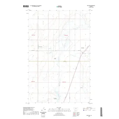
2020 Map of Box Elder
USGS Topo · Published 2020About this map
Box Elder serves as the primary settlement on this North-Central Montana landscape, situated near the boundary between Hill Co and Chouteau Co. The drainage patterns are defined by the meandering Big Sandy Creek and the smaller Boxelder Cr, which carve through the prairie terrain. Numerous coulees, including Jerome Coulee, Barneys Coulee, and Lonesome Lake Coulee, indicate the significant water erosion that has shaped the local topography over time. Small-scale water management is evident through the presence of Schmidt Reservoir and Grass Reservoir, which likely support the agricultural and ranching operations of the region. The road network is oriented around Broadway and Main St W, with rural access provided by routes such as Kremlin High Grade Rd and Drake Rd.
Find a feature on this map
25 named features on this map. Tap any name to fly to it.
Don’t see what you’re looking for? This feature index may not catch every label — zoom into the map to look around manually.
Map Details
Editions of this 2020 Box Elder Map
This is the sole edition of this map. No revisions or reprints were ever made.
Other maps of this area

1904 · Boxelder
USGS Topo · 1:62,500

1906 · Boxelder
USGS Topo · 1:62,500

1919 · Big Sandy
USGS Topo · 1:125,000

1953 · Havre
USGS Topo · 1:250,000

1954 · Shelby
USGS Topo · 1:250,000

1957 · Havre
USGS Topo · 1:250,000

1958 · Shelby
USGS Topo · 1:250,000

1958 · Havre
USGS Topo · 1:250,000

1959 · Laredo
USGS Topo · 1:62,500

1959 · Centennial Mountain
USGS Topo · 1:62,500