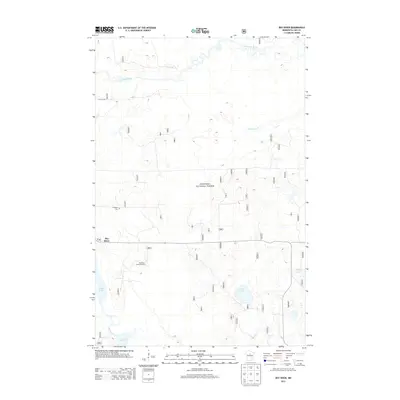
2013 Map of Boy River
USGS Topo · Published 2013About this map
Chippewa National Forest dominates this northern landscape, where the meandering Leech Lake River flows through a complex network of wetlands and small lakes. The small settlement of Boy River is situated along the southern edge of the forest, featuring a local Post Office and the nearby Boy River Lookout Tower, a classic fixture of mid-century fire detection in the Minnesota woods. To the north, the small community of Arlington is marked by the Arlington Cemetery. The map detail captures a low-lying glaciated terrain characterized by numerous water bodies, including Skelly Lake, Lucille Lake, and Boy Lake, reflecting a region defined more by its waterways and timber than by dense development. This survey provides a clear view of the rural infrastructure, from the graded path of 116th St NE to the isolated forest roads that crisscross the marshy lowlands.
Find a feature on this map
14 named features on this map. Tap any name to fly to it.
Don’t see what you’re looking for? This feature index may not catch every label — zoom into the map to look around manually.
Map Details
Editions of this 2013 Boy River Map
This is the sole edition of this map. No revisions or reprints were ever made.
Other maps of this area

1954 · Bemidji
USGS Topo · 1:250,000

1954 · Hibbing
USGS Topo · 1:250,000

1957 · Bemidji
USGS Topo · 1:250,000

1957 · Hibbing
USGS Topo · 1:250,000

1958 · Bemidji
USGS Topo · 1:250,000

1958 · Hibbing
USGS Topo · 1:250,000

1964 · Hibbing
USGS Topo · 1:250,000

1970 · Ball Club
USGS Topo · 1:24,000
1971 · Remer
USGS Topo · 1:24,000

1971 · Nushka Lake
USGS Topo · 1:24,000