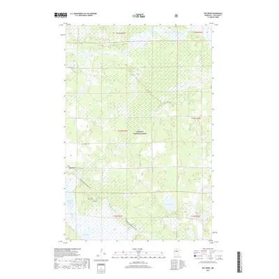
2019 Map of Boy River
USGS Topo · Published 2019About this map
The settlement of Boy River anchors this northern Minnesota landscape, where the Chippewa National Forest covers much of the wetland and forest terrain. Water dominates the geography, with the Leech Lake River flowing through the northern reaches and the larger expanse of Boy Lake situated to the south. Smaller water bodies like Skelly Lake and Lucille Lake are scattered throughout the low-lying areas, connected by smaller tributaries such as Little Bear Cr.
Find a feature on this map
18 named features on this map. Tap any name to fly to it.
Don’t see what you’re looking for? This feature index may not catch every label — zoom into the map to look around manually.
Map Details
Editions of this 2019 Boy River Map
This is the sole edition of this map. No revisions or reprints were ever made.
Other maps of this area

1954 · Bemidji
USGS Topo · 1:250,000

1954 · Hibbing
USGS Topo · 1:250,000

1957 · Bemidji
USGS Topo · 1:250,000

1957 · Hibbing
USGS Topo · 1:250,000

1958 · Bemidji
USGS Topo · 1:250,000

1958 · Hibbing
USGS Topo · 1:250,000

1964 · Hibbing
USGS Topo · 1:250,000

1970 · Ball Club
USGS Topo · 1:24,000
1971 · Remer
USGS Topo · 1:24,000

1971 · Nushka Lake
USGS Topo · 1:24,000