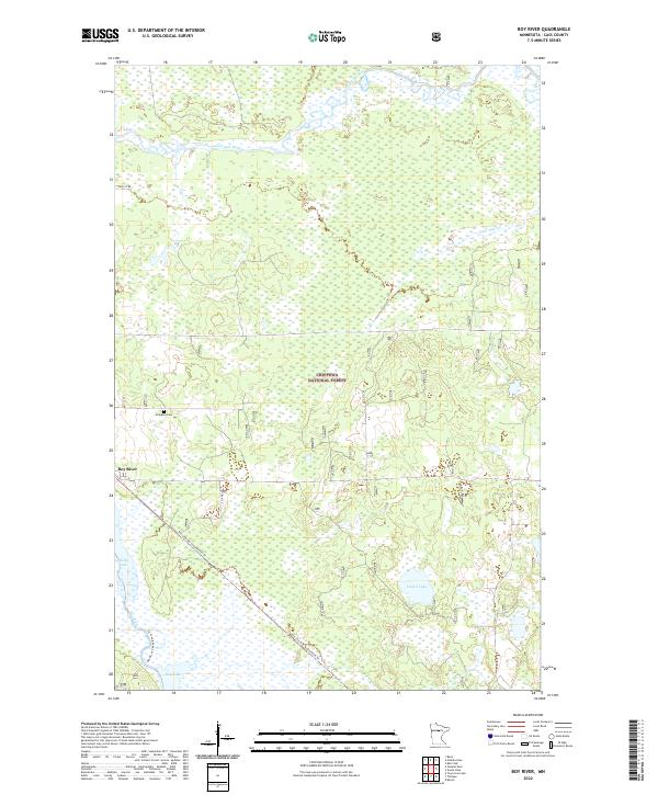
2022 Map of Boy River
USGS Topo · Published 2022About this map
Chippewa National Forest dominates this northern Minnesota landscape, where the Boy River settlement sits at a crossroads of water and woodland. The map reveals a region defined by its complex hydrology, featuring the expansive Boy Lake and the meandering Leech Lake River, alongside smaller bodies like Lucille Lake and Skelly Lake. Local history is anchored by the Arlington Cem north of the main settlement. The modern usage of the land is balanced between conservation and recreation, evidenced by the Soo Line Gia Snowmobile Trl and the Boy River Canoe Route Trl. The grid of the Public Land Survey System remains the primary framework for navigation through the dense wetlands and forests of Cass County, with Little Bear Cr cutting through the northeastern sections.
Find a feature on this map
19 named features on this map. Tap any name to fly to it.
Don’t see what you’re looking for? This feature index may not catch every label — zoom into the map to look around manually.
Map Details
Editions of this 2022 Boy River Map
This is the sole edition of this map. No revisions or reprints were ever made.
Other maps of this area

1954 · Bemidji
USGS Topo · 1:250,000

1954 · Hibbing
USGS Topo · 1:250,000

1957 · Bemidji
USGS Topo · 1:250,000

1957 · Hibbing
USGS Topo · 1:250,000

1958 · Bemidji
USGS Topo · 1:250,000

1958 · Hibbing
USGS Topo · 1:250,000

1964 · Hibbing
USGS Topo · 1:250,000

1970 · Ball Club
USGS Topo · 1:24,000
1971 · Remer
USGS Topo · 1:24,000

1971 · Nushka Lake
USGS Topo · 1:24,000