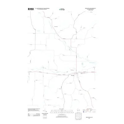
2013 Map of Boyceville
USGS Topo · Published 2013About this map
Boyceville serves as the central hub of this West Central Wisconsin landscape, where the confluence of several watercourses dictated the early development patterns of Dunn County. The village is positioned at the intersection of State Road 170 and State Road 79, with the Boyceville Municipal Airport situated on the eastern edge of the settlement. The hydrology of the region is notably complex, defined by the winding paths of the South Fork Hay River and Tiffany Cr, which converge near the town center. To the north, the distinctive Chimney Rock stands as a prominent landmark along the valley of the S Fork Hay River. The grid of rural routes, including Co Hwy-Q and numerous numbered avenues like 1210th Ave, reflects the organized agricultural expansion of the area, while the naming of Railroad Ave within the village preserves the memory of the transportation corridor that once anchored the local economy.
Find a feature on this map
58 named features on this map. Tap any name to fly to it.
Don’t see what you’re looking for? This feature index may not catch every label — zoom into the map to look around manually.
Map Details
Editions of this 2013 Boyceville Map
This is the sole edition of this map. No revisions or reprints were ever made.
Other maps of this area

1940 · Menomonie
USGS Topo · 1:62,500

1942 · Menomonie
USGS Topo · 1:62,500

1946 · Knapp
USGS Topo · 1:62,500

1948 · Downing
USGS Topo · 1:62,500

1949 · Knapp
USGS Topo · 1:62,500

1949 · Ridgeland
USGS Topo · 1:62,500

1950 · Downing
USGS Topo · 1:62,500

1951 · Ridgeland
USGS Topo · 1:62,500

1953 · Saint Paul
USGS Topo · 1:250,000

1953 · Eau Claire
USGS Topo · 1:250,000