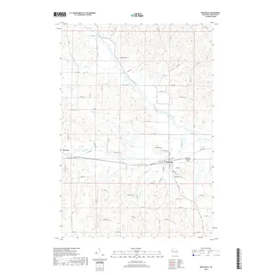
2018 Map of Boyceville
USGS Topo · Published 2018About this map
Boyceville and Downing anchor this western Wisconsin landscape where the winding waters of the South Fork Hay River and Tiffany Cr converge. The terrain is defined by a dense network of county roads and named avenues, including Co Rd N and Co Rd Q, which weave through the agricultural and wooded ridges. Local history is marked by quiet landmarks like Mound Cem near Downing and Tiffany Cem situated along the central rail corridor. The presence of the Boyceville Municipal Airport indicates the modern infrastructure serving this rural community, while natural features like Chimney Rock and Johns Cr highlight the distinct topography of Dunn County. The map provides a clear view of the rural sections and the organized street grids of the small townships during the early 21st century.
Find a feature on this map
68 named features on this map. Tap any name to fly to it.
Don’t see what you’re looking for? This feature index may not catch every label — zoom into the map to look around manually.
Map Details
Editions of this 2018 Boyceville Map
This is the sole edition of this map. No revisions or reprints were ever made.
Other maps of this area

1940 · Menomonie
USGS Topo · 1:62,500

1942 · Menomonie
USGS Topo · 1:62,500

1946 · Knapp
USGS Topo · 1:62,500

1948 · Downing
USGS Topo · 1:62,500

1949 · Knapp
USGS Topo · 1:62,500

1949 · Ridgeland
USGS Topo · 1:62,500

1950 · Downing
USGS Topo · 1:62,500

1951 · Ridgeland
USGS Topo · 1:62,500

1953 · Saint Paul
USGS Topo · 1:250,000

1953 · Eau Claire
USGS Topo · 1:250,000