
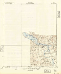
1930 Map of Boyd
USGS Topo · Published 1930About this map
The West Fork Trinity River winds through this Wise County landscape, which was surveyed in the mid-1920s during a period of transition for north-central Texas. The Chicago Rock Island and Gulf railroad serves as the primary industrial corridor, connecting the town of Boyd to outlying settlements. The southern portion of the map reveals a rural economy rooted in small school districts and scattered communities, including Aurora, Keeter, and Annaville.
Find a feature on this map
19 named features on this map. Tap any name to fly to it.
Don’t see what you’re looking for? This feature index may not catch every label — zoom into the map to look around manually.
Map Details
Editions of this 1930 Boyd Map
2 editions found
Other maps of this area

1891 · Weatherford
USGS Topo · 1:125,000

1893 · Weatherford
USGS Topo · 1:125,000

1894 · Fort Worth
USGS Topo · 1:125,000

1924 · Sunset 4-d
USGS Topo · 1:48,000

1932 · Springtown
USGS Topo · 1:62,500

1954 · Dallas
USGS Topo · 1:250,000

1954 · Sherman
USGS Topo · 1:250,000

1955 · Avondale
USGS Topo · 1:24,000

1955 · Azle
USGS Topo · 1:24,000

1955 · Haltom City
USGS Topo · 1:62,500