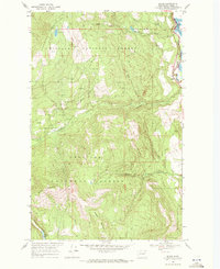
1969 Map of Boyds
USGS Topo · Published 1971About this map
Colville National Forest dominates this landscape, where the Columbia River valley meets the eastern foothills of the Kettle River Range. The settlement of Boyds sits at the edge of the Stevens and Ferry county line, serving as a point of interest for those tracking the Burlington Northern railroad route. This line follows the narrow corridor between the mountains and the river, mirroring the path of Route 395.
Find a feature on this map
20 named features on this map. Tap any name to fly to it.
Don’t see what you’re looking for? This feature index may not catch every label — zoom into the map to look around manually.
Map Details
Editions of this 1969 Boyds Map
2 editions found
Other maps of this area

1936 · Marcus
USGS Topo · 1:96,000

1942 · Marcus
USGS Topo · 1:125,000

1948 · Sherman Peak
USGS Topo · 1:62,500

1948 · Kettle Falls
USGS Topo · 1:62,500

1948 · Orient
USGS Topo · 1:62,500

1948 · Togo Mountain
USGS Topo · 1:62,500

1951 · Togo Mountain
USGS Topo · 1:62,500

1951 · Sherman Peak
USGS Topo · 1:62,500

1951 · Orient
USGS Topo · 1:62,500

1951 · Kettle Falls
USGS Topo · 1:62,500