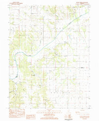
1983 Map of Boyer Creek
USGS Topo · Published 1984About this map
Macoupin Creek meanders through the central portion of this rural Illinois landscape, dividing the townships of Woodville and Kane. This early 1980s data illustrates a deeply agricultural region defined by its watercourses and a proliferation of family and community burial grounds that reflect generations of rural settlement. Genealogists will find a high density of small cemeteries such as Mt Gilead Cem, Reynolds Cem, and Bell Salem Cem, often situated near early congregations like Mt Gilead Ch and Bethany Ch. The terrain transitions from the broad floodplains of the creek into more dissected upland areas like Shanks Hill. Distinctive local landmarks including Dodson Spring and John Dunham Spring indicate the importance of natural water sources in the development of the Boyer Creek and Sugar Creek valleys.
Find a feature on this map
34 named features on this map. Tap any name to fly to it.
Don’t see what you’re looking for? This feature index may not catch every label — zoom into the map to look around manually.
Map Details
Editions of this 1983 Boyer Creek Map
This is the sole edition of this map. No revisions or reprints were ever made.
Other maps of this area

1924 · Roodhouse
USGS Topo · 1:62,500

1926 · Roodhouse
USGS Topo · 1:62,500

1930 · Pearl
USGS Topo · 1:62,500

1930 · Hardin
USGS Topo · 1:62,500

1930 · Jerseyville
USGS Topo · 1:62,500

1933 · Jerseyville
USGS Topo · 1:62,500

1934 · Hardin
USGS Topo · 1:62,500

1938 · Hardin
USGS Topo · 1:62,500

1948 · Quincy
USGS Topo · 1:250,000

1950 · Pearl
USGS Topo · 1:62,500