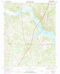
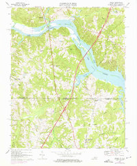
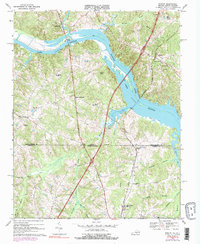
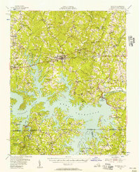
1968 Map of Bracey
USGS Topo · Published 1975About this map
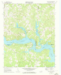
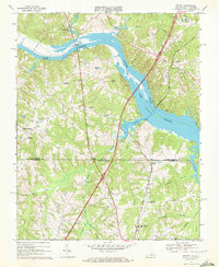
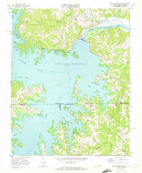
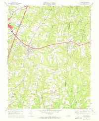
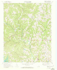
Lake Gaston dominates the upper half of this survey, with its waters backed up behind the John H. Kerr Dam to the west, flooding the old Roanoke River valley. The map documents the rural landscapes of southern Mecklenburg County, Virginia, and northern Warren County, North Carolina, at a time when the region's economy revolved around agricultural crossroads and small community hubs. The Seaboard Coast Line railroad cuts a diagonal path through the terrain, passing through Bracey and Paschall, serving as a primary transit corridor. Local life is anchored by numerous country churches, such as Roanoke Zion Ch and Bethlehem Ch, alongside educational landmarks like the North Warren High Sch and the Southside Sch. The presence of Palmer Springs and Palmer Crossroads suggests the historical importance of localized gathering places and early road junctions in this borderland territory.
Find a feature on this map
42 named features on this map. Tap any name to fly to it.
Don’t see what you’re looking for? This feature index may not catch every label — zoom into the map to look around manually.
Map Details
Editions of this 1968 Bracey Map
4 editions found
Other maps of this area

1953 · Greensboro
USGS Topo · 1:250,000

1954 · Greensboro
USGS Topo · 1:250,000
1955 · Boydton
USGS Topo · 1:62,500

1962 · Greensboro
USGS Topo · 1:250,000

1966 · Greensboro
USGS Topo · 1:250,000
1968 · South Hill SE
USGS Topo · 1:24,000
1968 · Bracey
USGS Topo · 1:24,000
1968 · John H Kerr Dam
USGS Topo · 1:24,000
1968 · La Crosse
USGS Topo · 1:24,000
1968 · Baskerville
USGS Topo · 1:24,000