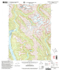
2000 Map of Bradfield Canal A-1
USGS Topo · Published 2003About this map
Nelson Glacier feeds into a complex network of waterways in this northern reach of the Tongass National Forest, illustrating the glaciated geography of Southeast Alaska. The landscape is defined by steep elevation changes, stretching from the peaks of Berg Mountain down to the saltwater of Blake Channel and the eastern edge of Wrangell Island. Interior access at the turn of the 21st century remained limited, primarily supported by Trail 527 and small remote outposts like the Marten Lake Cabin (FS) located near the shores of Marten Lake.
Find a feature on this map
22 named features on this map. Tap any name to fly to it.
Don’t see what you’re looking for? This feature index may not catch every label — zoom into the map to look around manually.
Map Details
Editions of this 2000 Bradfield Canal A-1 Map
This is the sole edition of this map. No revisions or reprints were ever made.
Other maps of this area

1951 · Bradfield Canal
USGS Topo · 1:250,000

1952 · Ketchikan
USGS Topo · 1:250,000

1954 · Bradfield Canal
USGS Topo · 1:250,000

1955 · Bradfield canal B-2
USGS Topo · 1:63,360

1955 · Ketchikan D-2
USGS Topo · 1:63,360

1955 · Bradfield canal A-2
USGS Topo · 1:63,360

1955 · Bradfield Canal A-1
USGS Topo · 1:63,360

1955 · Ketchikan D-1
USGS Topo · 1:63,360

1955 · Ketchikan
USGS Topo · 1:250,000

1955 · Bradfield Canal
USGS Topo · 1:250,000