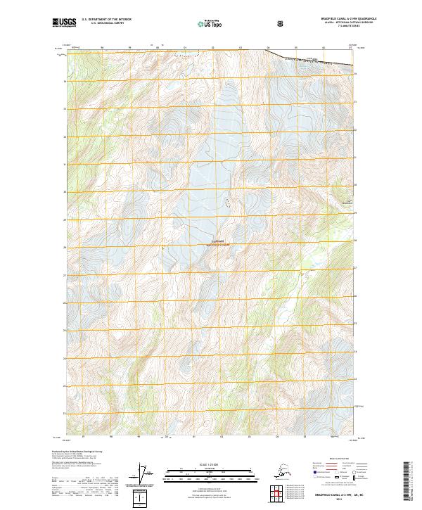
2021 Map of Bradfield Canal A-2 NW
USGS Topo · Published 2021About this map
Tongass National Forest dominates this section of the Coast Mountains along the international boundary between the United States and Canada. The landscape is defined by severe glacial activity and high alpine hydrology, where the Grassy Creek Glacier feeds into steep drainage systems. To the north, Smith Lake sits near the headwaters of these glacial flows, while the Leduc River carves through the southern portion of the quadrangle. This 2021 survey provides a contemporary view of these protected federal lands, illustrating the complex relationship between permanent ice fields and the riparian corridors of the Alaskan panhandle. The map documents the remote terrain surrounding Mt Blaine, highlighting the stark relief and significant elevation changes characteristic of this wilderness region.
Find a feature on this map
11 named features on this map. Tap any name to fly to it.
Don’t see what you’re looking for? This feature index may not catch every label — zoom into the map to look around manually.
Map Details
Editions of this 2021 Bradfield Canal A-2 NW Map
This is the sole edition of this map. No revisions or reprints were ever made.
Other maps of this area

1951 · Bradfield Canal
USGS Topo · 1:250,000

1954 · Bradfield Canal
USGS Topo · 1:250,000

1955 · Bradfield canal B-2
USGS Topo · 1:63,360

1955 · Bradfield canal B-3
USGS Topo · 1:63,360

1955 · Bradfield canal A-2
USGS Topo · 1:63,360

1955 · Bradfield canal A-3
USGS Topo · 1:63,360

1955 · Bradfield Canal
USGS Topo · 1:250,000
1973 · Bradfield Canal B-2
USGS Topo · 1:63,360
2000 · Bradfield Canal A-2
USGS Topo · 1:63,360
2018 · Bradfield Canal A-3 SE
USGS Topo · 1:25,000