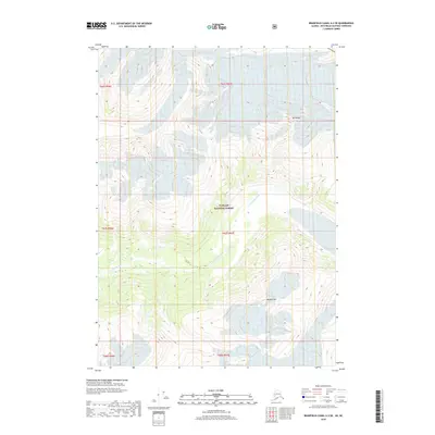
2018 Map of Bradfield Canal A-2 SE
USGS Topo · Published 2018About this map
Tongass National Forest dominates this landscape, where steep elevations and complex glacial topography define the terrain. The Chickamin River winds through the central valley, serving as the primary drainage for the surrounding peaks. To the north, Mt Wilson stands as a prominent landmark, while Bonded Mtn rises to the south, marking the high points of the local ridges. The map illustrates a wilderness area structured by the Public Land Survey System, with township and range lines like t67s r97e overlaying the natural features. This specific survey provides a precise record of river paths and mountain heights in a region where the geography itself dictates the patterns of exploration and land management.
Find a feature on this map
10 named features on this map. Tap any name to fly to it.
Don’t see what you’re looking for? This feature index may not catch every label — zoom into the map to look around manually.
Map Details
Editions of this 2018 Bradfield Canal A-2 SE Map
This is the sole edition of this map. No revisions or reprints were ever made.
Other maps of this area

1951 · Bradfield Canal
USGS Topo · 1:250,000

1952 · Ketchikan
USGS Topo · 1:250,000

1954 · Bradfield Canal
USGS Topo · 1:250,000

1955 · Ketchikan D-2
USGS Topo · 1:63,360

1955 · Bradfield canal A-2
USGS Topo · 1:63,360

1955 · Bradfield Canal A-1
USGS Topo · 1:63,360

1955 · Ketchikan D-1
USGS Topo · 1:63,360

1955 · Ketchikan
USGS Topo · 1:250,000

1955 · Bradfield Canal
USGS Topo · 1:250,000
1996 · Bradfield Canal A-1
USGS Topo · 1:63,360