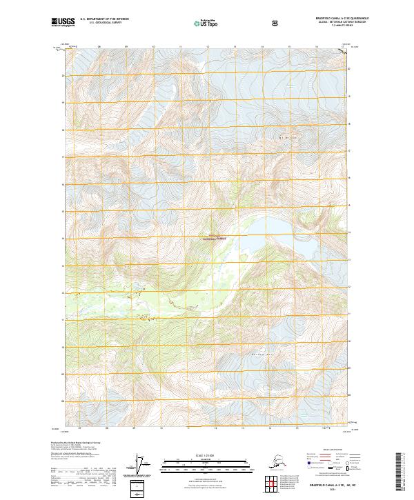
2021 Map of Bradfield Canal A-2 SE
USGS Topo · Published 2021About this map
Chickamin River winds through this heavily glaciated region within the Tongass National Forest, illustrating the dramatic glacial topography of Southeast Alaska. This modern survey, produced by the U.S. Geological Survey, records the current state of frozen landscapes and high-altitude peaks such as Mt Wilson and Banded Mtn. The map shows the expansive reaches of the Chickamin Glacier and Through Glacier, which feed the river systems below. These features are critical for understanding the hydrological and geomorphic character of the Bradfield Canal area, where vertical relief and moving ice dominate the environment. The lack of roads or established settlements emphasizes the wilderness character of this federal land, serving as a baseline for environmental study and mountaineering navigation.
Find a feature on this map
12 named features on this map. Tap any name to fly to it.
Don’t see what you’re looking for? This feature index may not catch every label — zoom into the map to look around manually.
Map Details
Editions of this 2021 Bradfield Canal A-2 SE Map
This is the sole edition of this map. No revisions or reprints were ever made.
Other maps of this area

1951 · Bradfield Canal
USGS Topo · 1:250,000

1952 · Ketchikan
USGS Topo · 1:250,000

1954 · Bradfield Canal
USGS Topo · 1:250,000

1955 · Ketchikan D-2
USGS Topo · 1:63,360

1955 · Bradfield canal A-2
USGS Topo · 1:63,360

1955 · Bradfield Canal A-1
USGS Topo · 1:63,360

1955 · Ketchikan D-1
USGS Topo · 1:63,360

1955 · Ketchikan
USGS Topo · 1:250,000

1955 · Bradfield Canal
USGS Topo · 1:250,000
1996 · Bradfield Canal A-1
USGS Topo · 1:63,360