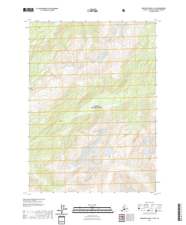
2021 Map of Bradfield Canal A-3 NE
USGS Topo · Published 2021About this map
The Coast Mountains dominate this remote Alaskan landscape, where the high peaks and glaciers of the Tongass National Forest transition into deeply carved drainage systems. This 2021 digital survey by the U.S. Geological Survey maps a rugged interior wilderness where natural elevation and glacial hydrology dictate the terrain. The presence of Lake Cr winding through the steep valleys highlights the importance of freshwater runoff in this part of the Ketchikan Gateway Borough. Because this area lacks modern road infrastructure or permanent settlements, the map focuses on precise topographical data and the natural hydrography essential for navigating the Alaskan backcountry. Researchers can trace the complex network of mountain ridges and unnamed glacial features that define this high-latitude ecosystem.
Find a feature on this map
7 named features on this map. Tap any name to fly to it.
Don’t see what you’re looking for? This feature index may not catch every label — zoom into the map to look around manually.
Map Details
Editions of this 2021 Bradfield Canal A-3 NE Map
This is the sole edition of this map. No revisions or reprints were ever made.
Other maps of this area

1951 · Bradfield Canal
USGS Topo · 1:250,000

1954 · Bradfield Canal
USGS Topo · 1:250,000

1955 · Bradfield canal B-2
USGS Topo · 1:63,360

1955 · Bradfield canal B-3
USGS Topo · 1:63,360

1955 · Bradfield canal A-2
USGS Topo · 1:63,360

1955 · Bradfield canal A-3
USGS Topo · 1:63,360

1955 · Bradfield Canal
USGS Topo · 1:250,000
1973 · Bradfield Canal B-2
USGS Topo · 1:63,360
2000 · Bradfield Canal A-2
USGS Topo · 1:63,360
2018 · Bradfield Canal A-3 SE
USGS Topo · 1:25,000