
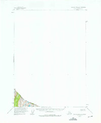
1955 Map of Bradfield canal B-2
USGS Topo · Published 1959About this map
Mt Middleton anchors the southwestern corner of this survey, standing at the edge of the international border between the United States and Canada. The landscape is dominated by the wilderness of the Tongass National Forest, where high-elevation terrain gives way to localized water bodies such as Boundary Lake and Smith Lake.
Find a feature on this map
8 named features on this map. Tap any name to fly to it.
Don’t see what you’re looking for? This feature index may not catch every label — zoom into the map to look around manually.
Map Details
Editions of this 1955 Bradfield canal B-2 Map
2 editions found
Other maps of this area

1951 · Bradfield Canal
USGS Topo · 1:250,000

1954 · Bradfield Canal
USGS Topo · 1:250,000

1955 · Bradfield canal B-3
USGS Topo · 1:63,360

1955 · Bradfield canal A-2
USGS Topo · 1:63,360

1955 · Bradfield Canal A-1
USGS Topo · 1:63,360

1955 · Bradfield canal A-3
USGS Topo · 1:63,360

1955 · Bradfield Canal
USGS Topo · 1:250,000
1973 · Bradfield Canal B-2
USGS Topo · 1:63,360
1996 · Bradfield Canal A-1
USGS Topo · 1:63,360
1997 · Bradfield Canal A-1
USGS Topo · 1:63,360