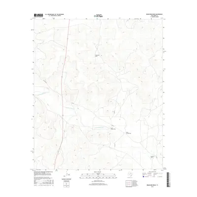
2016 Map of Bradford Draw
USGS Topo · Published 2016About this map
The Middle Concho River winds through this West Texas landscape, defining the primary drainage pattern for a series of ephemeral watercourses. This arid terrain is characterized by deeply etched features such as Telephone Draw and Bradford Draw, which channel seasonal runoff toward the river. The map illustrates a ranching-oriented infrastructure where movement is dictated by a network of rural routes including State Highway 163, Wales Rd, and Bacon Bind Rd. These roads often follow the natural contours of the draws, such as where Co Rd 411 parallels the Concho. The convergence of North Liveoak Draw and South Liveoak Draw highlights the complex local topography, where subtle elevation changes guide the flow of water through the limestone-influenced landscape of Irion County.
Find a feature on this map
11 named features on this map. Tap any name to fly to it.
Don’t see what you’re looking for? This feature index may not catch every label — zoom into the map to look around manually.
Map Details
Editions of this 2016 Bradford Draw Map
This is the sole edition of this map. No revisions or reprints were ever made.
Other maps of this area

1895 · Sherwood
USGS Topo · 1:125,000

1921 · Ketchum Mountain
USGS Topo · 1:62,500

1923 · Ketchum Mountain
USGS Topo · 1:62,500

1954 · San Angelo
USGS Topo · 1:250,000

1958 · San Angelo
USGS Topo · 1:250,000

1965 · San Angelo
USGS Topo · 1:250,000

1972 · Wallace Draw
USGS Topo · 1:24,000
1972 · Mertzon SW
USGS Topo · 1:24,000

1972 · Dog Creek SW
USGS Topo · 1:24,000

1973 · Hay Hollow
USGS Topo · 1:24,000