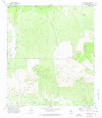
1972 Map of Mertzon SW
USGS Topo · Published 1974About this map
The Middle Concho River defines the northern edge of this West Texas landscape, winding through Irion County during the early 1970s. The terrain is characterized by a network of seasonal watercourses, including Big Hollow Draw, Lopez Creek, and Rock Pen Draw, which illustrate the natural drainage patterns of the Edwards Plateau. Evidence of local industry and resource extraction is scattered across the sheet, marked by several Oil Well sites, a Radio Tower, and various Drill Hole locations. Small-scale excavation is also present, with Gravel Pits located near the river and southern draws. This survey provides a clear look at the rural infrastructure of the era, where isolated wells and unimproved roads served a sparsely populated ranching and petroleum-producing region.
Find a feature on this map
11 named features on this map. Tap any name to fly to it.
Don’t see what you’re looking for? This feature index may not catch every label — zoom into the map to look around manually.
Map Details
Editions of this 1972 Mertzon SW Map
2 editions found
Other maps of this area

1895 · Sherwood
USGS Topo · 1:125,000

1920 · Barnhart
USGS Topo · 1:62,500

1921 · Ketchum Mountain
USGS Topo · 1:62,500

1922 · Barnhart
USGS Topo · 1:62,500

1923 · Ketchum Mountain
USGS Topo · 1:62,500

1954 · San Angelo
USGS Topo · 1:250,000

1958 · San Angelo
USGS Topo · 1:250,000

1965 · San Angelo
USGS Topo · 1:250,000

1971 · Noelke
USGS Topo · 1:24,000
1971 · Barnhart NE
USGS Topo · 1:24,000