
1972 Map of Wallace Draw
USGS Topo · Published 1974About this map
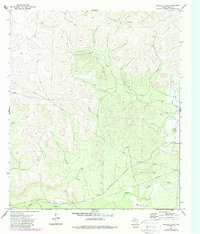
The Middle Concho River winds through the southern reaches of this Irion County landscape, providing a critical water source in an otherwise arid West Texas environment. The terrain is defined by dramatic ephemeral drainages, most notably Wallace Draw and Dry Creek, which carve deep contours into the plateau. While much of the land remains open range, the presence of the Sugg Ranch headquarters near the river indicates the area's long-standing ranching heritage. Industrial development is visible through a network of Pipeline corridors and several Gravel Pits, alongside infrastructure like a Pumping Sta and a scattered Well. This 1972 survey records a moment when traditional land use met the expanding needs of energy and material transport, marked by isolated features such as a Drill Hole in the northern heights.
Find a feature on this map
10 named features on this map. Tap any name to fly to it.
Don’t see what you’re looking for? This feature index may not catch every label — zoom into the map to look around manually.
Map Details
Editions of this 1972 Wallace Draw Map
2 editions found
Other maps of this area

1895 · Sherwood
USGS Topo · 1:125,000

1921 · Ketchum Mountain
USGS Topo · 1:62,500

1923 · Ketchum Mountain
USGS Topo · 1:62,500

1954 · San Angelo
USGS Topo · 1:250,000

1958 · San Angelo
USGS Topo · 1:250,000

1965 · San Angelo
USGS Topo · 1:250,000

1972 · Arden
USGS Topo · 1:24,000
1972 · Mertzon SW
USGS Topo · 1:24,000

1972 · Dog Creek SW
USGS Topo · 1:24,000
1972 · Mertzon
USGS Topo · 1:24,000