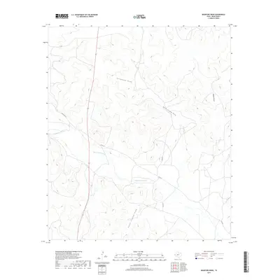
2019 Map of Bradford Draw
USGS Topo · Published 2019About this map
The Middle Concho River meanders across this West Texas landscape, serving as the primary hydrological artery for a region defined by its wide, dry drainage systems. These topographic features, including Telephone Draw, North Liveoak Draw, and South Liveoak Draw, illustrate the complex watershed patterns of Irion County. State Highway 163 provides the principal north-south transit corridor, bisecting the terrain where low-traffic rural routes like Bacon Rind Rd and 7 D Rd connect isolated ranching properties. The network of roads and natural draws, such as Bradford Draw, reflects a land-use pattern centered on large-scale livestock operations and the management of scarce water resources in a semi-arid environment.
Find a feature on this map
11 named features on this map. Tap any name to fly to it.
Don’t see what you’re looking for? This feature index may not catch every label — zoom into the map to look around manually.
Map Details
Editions of this 2019 Bradford Draw Map
This is the sole edition of this map. No revisions or reprints were ever made.
Other maps of this area

1895 · Sherwood
USGS Topo · 1:125,000

1921 · Ketchum Mountain
USGS Topo · 1:62,500

1923 · Ketchum Mountain
USGS Topo · 1:62,500

1954 · San Angelo
USGS Topo · 1:250,000

1958 · San Angelo
USGS Topo · 1:250,000

1965 · San Angelo
USGS Topo · 1:250,000

1972 · Wallace Draw
USGS Topo · 1:24,000
1972 · Mertzon SW
USGS Topo · 1:24,000

1972 · Dog Creek SW
USGS Topo · 1:24,000

1973 · Hay Hollow
USGS Topo · 1:24,000