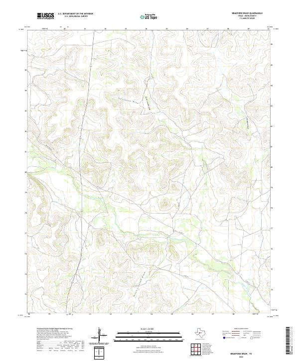
2022 Map of Bradford Draw
USGS Topo · Published 2022About this map
The Middle Concho River cuts a winding path through this portion of Irion County, defining a landscape shaped by intermittent drainage systems. These arid watercourses, including Telephone Draw, North Liveoak Draw, and South Liveoak Draw, illustrate the complex hydrology of the Edwards Plateau. The map captures the intersection of ranching infrastructure and geography, where local routes like Bacon Ring Rd and 7 D Rd provide access across the high ground between the draws. The concentration of named draws like Bradford Draw highlights the importance of these natural topographic features in a region where water management and movement are central to land use. Rural connectivity is maintained through a network of county roads, including Co Rd 411 and Wales Rd, which follow the contours of the terrain.
Find a feature on this map
10 named features on this map. Tap any name to fly to it.
Don’t see what you’re looking for? This feature index may not catch every label — zoom into the map to look around manually.
Map Details
Editions of this 2022 Bradford Draw Map
This is the sole edition of this map. No revisions or reprints were ever made.
Other maps of this area

1895 · Sherwood
USGS Topo · 1:125,000

1921 · Ketchum Mountain
USGS Topo · 1:62,500

1923 · Ketchum Mountain
USGS Topo · 1:62,500

1954 · San Angelo
USGS Topo · 1:250,000

1958 · San Angelo
USGS Topo · 1:250,000

1965 · San Angelo
USGS Topo · 1:250,000

1972 · Wallace Draw
USGS Topo · 1:24,000
1972 · Mertzon SW
USGS Topo · 1:24,000

1972 · Dog Creek SW
USGS Topo · 1:24,000

1973 · Hay Hollow
USGS Topo · 1:24,000