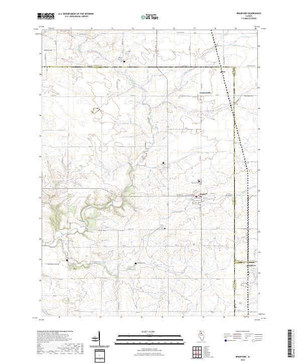
2024 Map of Bradford
USGS Topo · Published 2024About this map
Bradford serves as the primary hub in this corner of North Central Illinois, where the borders of Stark, Bureau, and Marshall counties converge. The landscape is defined by the winding course of the East Fork Spoon River, which feeds into Marsh Lake and is joined by tributaries like Cooper Defeat Creek and Silver Creek. This agricultural region is dotted with numerous small family and community burial grounds, including Mount Pleasant Cem, Smith Cem, and Hall Cem, providing essential markers for genealogists researching the area's rural heritage.
Find a feature on this map
67 named features on this map. Tap any name to fly to it.
Don’t see what you’re looking for? This feature index may not catch every label — zoom into the map to look around manually.
Map Details
Editions of this 2024 Bradford Map
This is the sole edition of this map. No revisions or reprints were ever made.
Other maps of this area

1921 · Buda
USGS Topo · 1:62,500

1923 · Buda
USGS Topo · 1:62,500

1929 · Annawan
USGS Topo · 1:62,500

1932 · Annawan
USGS Topo · 1:62,500

1933 · Camp Grove
USGS Topo · 1:48,000

1944 · Kewanee
USGS Topo · 1:62,500

1945 · Bradford
USGS Topo · 1:62,500

1958 · Aurora
USGS Topo · 1:250,000

1961 · Aurora
USGS Topo · 1:250,000
1983 · Castleton
USGS Topo · 1:24,000