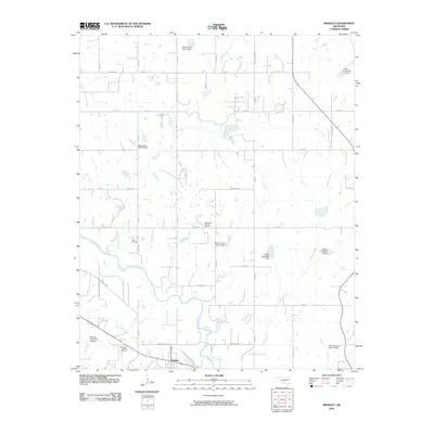
2010 Map of Bradley
USGS Topo · Published 2010About this map
Washita River dominates the southern landscape of this Oklahoma quadrangle, meandering past the town of Bradley and the Northwest Bradley Oil Field. The terrain is defined by an extensive network of water management, evidenced by numerous flood control structures such as Winter Creek Site 21 Dam, Colbert Creek Site 1 Dam, and Bear Hybarger Site 3a Dam. These dams, scattered along tributaries like Colbert Creek and Laflin Creek, reflect a landscape engineered to protect the agricultural and petroleum interests of the region.
Find a feature on this map
46 named features on this map. Tap any name to fly to it.
Don’t see what you’re looking for? This feature index may not catch every label — zoom into the map to look around manually.
Map Details
Editions of this 2010 Bradley Map
This is the sole edition of this map. No revisions or reprints were ever made.
Other maps of this area

1902 · Rush Springs
USGS Topo · 1:125,000

1904 · Chickasha
USGS Topo · 1:125,000

1949 · Rush Springs
USGS Topo · 1:62,500

1950 · Rush Springs
USGS Topo · 1:62,500

1954 · Oklahoma City
USGS Topo · 1:250,000

1957 · Ardmore
USGS Topo · 1:250,000

1957 · Oklahoma City
USGS Topo · 1:250,000

1963 · Ardmore
USGS Topo · 1:250,000

1963 · Oklahoma City
USGS Topo · 1:250,000
1965 · Cole
USGS Topo · 1:24,000