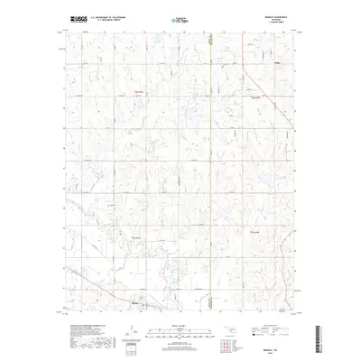
2018 Map of Bradley
USGS Topo · Published 2018About this map
The Washita River meanders across the southern landscape of this 2018 survey, defining the geography of the Grady and McClain county line. The small settlement of Bradley sits just south of the river, positioned near the confluence of Slough Cr and the main channel. To the north, the community of Dibble marks the higher ground, connected to the surrounding countryside by a dense grid of rural roads such as Co Line Rd and River Rd.
Find a feature on this map
60 named features on this map. Tap any name to fly to it.
Don’t see what you’re looking for? This feature index may not catch every label — zoom into the map to look around manually.
Map Details
Editions of this 2018 Bradley Map
This is the sole edition of this map. No revisions or reprints were ever made.
Other maps of this area

1902 · Rush Springs
USGS Topo · 1:125,000

1904 · Chickasha
USGS Topo · 1:125,000

1949 · Rush Springs
USGS Topo · 1:62,500

1950 · Rush Springs
USGS Topo · 1:62,500

1954 · Oklahoma City
USGS Topo · 1:250,000

1957 · Ardmore
USGS Topo · 1:250,000

1957 · Oklahoma City
USGS Topo · 1:250,000

1963 · Ardmore
USGS Topo · 1:250,000

1963 · Oklahoma City
USGS Topo · 1:250,000
1965 · Cole
USGS Topo · 1:24,000