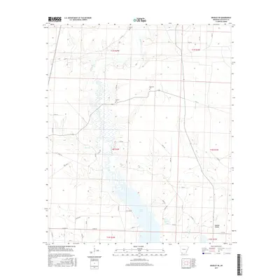
2017 Map of Bradley NE
USGS Topo · Published 2017About this map
Lake Erling dominates the southern landscape of Lafayette County in this recent survey, its waters reaching into the marshy lowlands of the Bodcau Creek basin. The terrain is characterized by the complex drainage patterns of Heirs Br, Walker Cr, and Bandy Br, which define the agricultural and timbered reaches of the Arkansas backcountry. Small, rural cemeteries including Demoss Cem, McClendon Cem, and Primitive Cem are scattered across the township lines, marking long-standing family and community sites near the settlement of Forest Grove. This map provides a clear view of the modern road network, from established routes like Collier Rd and Barton Rd to local timber and access paths such as Bandy Trl and Barry Trl, illustrating the continued intersection of water management and rural development in the region.
Find a feature on this map
49 named features on this map. Tap any name to fly to it.
Don’t see what you’re looking for? This feature index may not catch every label — zoom into the map to look around manually.
Map Details
Editions of this 2017 Bradley NE Map
This is the sole edition of this map. No revisions or reprints were ever made.
Other maps of this area

1952 · Bradley
USGS Topo · 1:24,000

1952 · Garland
USGS Topo · 1:24,000

1952 · Bradley NE
USGS Topo · 1:24,000

1952 · Canfield
USGS Topo · 1:24,000

1952 · Lewisville
USGS Topo · 1:24,000

1952 · Bradley SE
USGS Topo · 1:24,000

1953 · El Dorado
USGS Topo · 1:250,000

1957 · El Dorado
USGS Topo · 1:250,000

1958 · El Dorado
USGS Topo · 1:250,000

1960 · El Dorado
USGS Topo · 1:250,000