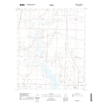
2020 Map of Bradley NE
USGS Topo · Published 2020About this map
Lake Erling dominates the southern landscape of this Lafayette County region, where the winding course of Bodcau Creek feeds into the reservoir's northern reaches. The settlement of Forest Grove sits in the southeast, situated near the headwaters of Walker Cr. This area is defined by a dense network of local roads and trails, such as Homan Rd and Collier Rd, which connect scattered homesteads and small cemeteries across the timbered terrain. Family history is preserved at several small burial grounds, including Demoss Cem in the north and McClendon Cem further south. The drainage patterns of smaller tributaries like Heirs Br and Blandy Br reveal the complex hydrology of the Bodcau Bayou watershed before it crosses into Louisiana.
Find a feature on this map
47 named features on this map. Tap any name to fly to it.
Don’t see what you’re looking for? This feature index may not catch every label — zoom into the map to look around manually.
Map Details
Editions of this 2020 Bradley NE Map
This is the sole edition of this map. No revisions or reprints were ever made.
Other maps of this area

1952 · Bradley
USGS Topo · 1:24,000

1952 · Garland
USGS Topo · 1:24,000

1952 · Bradley NE
USGS Topo · 1:24,000

1952 · Canfield
USGS Topo · 1:24,000

1952 · Lewisville
USGS Topo · 1:24,000

1952 · Bradley SE
USGS Topo · 1:24,000

1953 · El Dorado
USGS Topo · 1:250,000

1957 · El Dorado
USGS Topo · 1:250,000

1958 · El Dorado
USGS Topo · 1:250,000

1960 · El Dorado
USGS Topo · 1:250,000