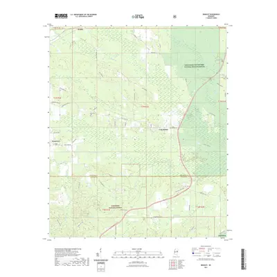
2021 Map of Bradley
USGS Topo · Published 2021About this map
The Noxubee River and its intricate tributaries, such as Parker Slough and Cypress Creek, anchor the landscape of this region on the border of Oktibbeha and Winston Counties. This rural expanse is defined by significant federal conservation areas, with the Sam D Hamilton Noxubee National Wildlife Refuge dominating the northeast and the Tombigbee National Forest stretching across the south.
Find a feature on this map
63 named features on this map. Tap any name to fly to it.
Don’t see what you’re looking for? This feature index may not catch every label — zoom into the map to look around manually.
Map Details
Editions of this 2021 Bradley Map
This is the sole edition of this map. No revisions or reprints were ever made.
Other maps of this area

1953 · West Point
USGS Topo · 1:250,000

1958 · West Point
USGS Topo · 1:250,000

1963 · West Point
USGS Topo · 1:250,000

1965 · Starkville
USGS Topo · 1:24,000

1965 · Bluff Lake
USGS Topo · 1:24,000

1965 · Longview
USGS Topo · 1:24,000

1965 · Bradley
USGS Topo · 1:24,000

1972 · Louisville North
USGS Topo · 1:24,000

1972 · Double Springs
USGS Topo · 1:24,000

1972 · Sturgis
USGS Topo · 1:24,000